

Biodiversity net gain evidence before the metric is run.
BNG assessment baseline, priority habitat, condition and the off-site market for your red line, read by the Vireo Neural Map before the habitat survey and the statutory biodiversity metric. Settle exemptions, brief your ecologist and plan the biodiversity gain plan from day one.
Every enquiry is reviewed by the Vireo team. We reply within two working days.
Free BNG exemption check. Six questions and the tests GOV.UK published on 6 August 2026, applied to your site.
Check exemptions →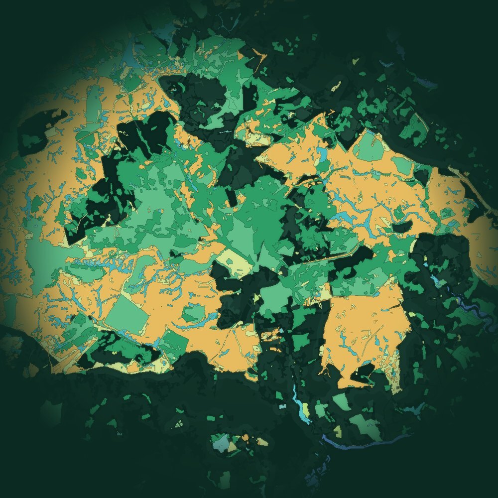
Habitat · Condition · Priority habitat · Terrain · Water. One baseline for the metric.
One site, every layer
BNG assessment, condition and priority habitat on one grid, before the survey.
Your records and the public evidence for your red line are placed on one grid, so the baseline, the condition assessment, the priority habitat question and the off-site options all answer from the same evidence. Shown: habitat classes read across a lowland site.
- 4Signals on one 50 m gridWater held in the terrain, surface change from LiDAR, ground motion from radar, and soil depth with a band.
- 3Ways to read conditionWorking classes at 1 m, a satellite read at 10 m, and one harmonised score, side by side, with the cells where they disagree.
- 1Plan for where to look nextThe cells to check first, and a probe or survey plan with its expected gain stated in advance.
From scoping to consent
Evidence for every biodiversity net gain decision.
Site selection and due diligence
Priority habitat, designations and habitat condition across the whole search area, so the land you option carries a BNG cost you can price. See a live site read →
BNG exemption check
The 0.2 hectare, de minimis, temporary and householder tests applied to your red line, with the priority habitat question answered from the evidence. Free BNG exemption checker →
BNG assessment and the statutory metric
Habitat types, area and condition read before the survey, so your ecologist runs the statutory biodiversity metric on a baseline that holds and visits the cells that change the answer.
Biodiversity gain plan
On-site gains placed where habitat will establish, with the baseline evidence the local planning authority asks for, from the plan to approval before development begins.
BNG units, credits and habitat banks
Registered gain sites read against your site, and for landowners, the land that would make the strongest habitat bank. BNG baseline guide →
Condition assessment and 30-year monitoring
Habitat condition read again on a schedule from satellite and LiDAR, so the gain the plan promised can be shown year after year.
Why this matters
Before anyone goes to site, someone has to decide where to focus. The records exist: gauge readings in a spreadsheet, a drainage survey in a PDF, a boundary in a GIS file. The pack reads them together and answers the question.
What the evidence supports, and where to firm it up
Main findings, the key uncertainties, and the recommended next step, written for the person who has to sign off the budget.
Every layer on the same grid
Peat and soil, terrain and wetness, satellite condition, surface change and ground motion, water and catchment context, read on one 10 m grid, 1 m where LiDAR is held.
What you supplied, how it was used
Each file checked for format, coverage, date, licence and relevance, then placed on the same grid as the public sources. Not an attachment at the back.
Source, date, licence, limitation
Every figure carries where it came from, when, under what licence and with what evidence tier, so it can be explained to colleagues, clients, funders or regulators.
Where to look next, in order
The cells where the reads disagree, the gaps in your records, and a walkable plan for probing, monitoring or assessment, with the expected gain stated before anyone walks it.
Thirty minutes on the findings
One factual-correction round and one call to walk through the pack and agree the next step.
What a site check looks like
Your site, read by the Vireo Neural Map.
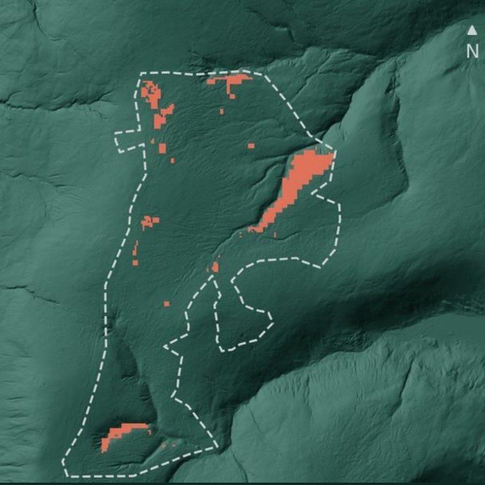
Priority habitat on a real site, the baseline by habitat type, the off-site market your units would come from, and where the reads disagree. Different questions, one method. Your pack carries the layers that matter for your decision.
Proof behind every figure
Declared before it is scored. Scored once. Published either way.
Vireo sealed-test register, October 2026. See the blind-tested results
How it works
Send a boundary and your records. Get back a pack and a plan.
Send a boundary and your decision
One boundary, the decision you need to make, and a note of the records you hold. We confirm the site fits before you order.
We read your records with the public evidence
Up to ten of your files and the public evidence for that ground, placed on one grid and read together.
Pack in your hands
The pack, one factual-correction round and a 30-minute handover call on the findings and the next step.
Who it is for
Housebuilders and land promoters
BNG costed and exemptions settled before an option is signed.
Ecologists and planning consultants
A baseline brief and survey priorities before the first site visit.
Landowners and habitat banks
Land read for gain site potential, condition and 30-year monitoring.
Launch offer
Ten sites at the launch price.
The pack briefs, and sits alongside, the habitat survey and statutory metric your ecologist signs.
Excluding VAT where applicable. The standard Site Evidence Pack price is £9,600 a site. The first three launch sites are delivered and reviewed before the remaining seven places open.
You pay £3,600 for the pack. You also receive a £3,600 credit towards a Vireo Site Assessment (£25,000), the calibrated read with sealed checks on your own probes, valid for 12 months from delivery of the pack.
Questions
Prices exclude VAT where applicable. Example outputs are from one anonymised upland site and show the format of your pack.
What is a BNG assessment?
In England most planning permissions must deliver at least a 10 per cent biodiversity net gain, measured with the statutory biodiversity metric against the habitat on site on the day the application is made. Vireo reads that baseline before the survey: habitat types, priority habitat, condition from satellite and LiDAR, and the cells your ecologist should check first, so the BNG assessment and metric run on a baseline that holds.
Which developments are exempt from biodiversity net gain?
Householder applications, sites of 0.2 hectares or below (applications made on or after 6 August 2026), de minimis development under 25 square metres of habitat and 5 metres of hedgerow, temporary permissions of 5 years or less, and a short list of others. The 0.2 hectare, de minimis and temporary exemptions fall away if the development impacts priority habitat on site. Our free BNG exemption checker applies the tests GOV.UK published.
What is a biodiversity gain plan?
The plan a developer submits to the local planning authority after permission is granted, which must be approved before development begins. It sets out the baseline, the on-site and off-site gains, and how significant gains are secured and managed for at least 30 years. Vireo supplies the baseline evidence and the condition monitoring the plan relies on.
What is the difference between BNG units and statutory credits?
BNG units are bought from registered off-site gain sites, often called habitat banks. Statutory biodiversity credits are sold by government as a last resort when on-site and off-site gains cannot meet the requirement. On 4 November 2026 the Biodiversity Gain Site Register held 421 gain sites covering 12,748 hectares, and 163 of them had not yet sold to any development.
Does biodiversity net gain apply to infrastructure projects?
Yes. BNG applies to Nationally Significant Infrastructure Projects from 2 November 2026, under a separate regime that covers the habitats a project affects. For linear routes the baseline is read along the whole corridor, so cable, pipeline, road and rail schemes see their units before design is fixed.
What does it cost?
£3,600 a site at the launch price, excluding VAT, credited against the Site Assessment (£25,000) that follows. The BNG exemption checker is free.